
Nantuo Fm
Type Locality and Naming
The name Nantuo Fm derived from the Nantuo Tillite named by B. Willis in 1907 and formally renamed by Li Siguang (J. S. Lee) and Zhao Yazeng (Y. T. Chao) in 1924. The typical section is situated in Nantuo in Sandouping Town in Yichang County, and the reference section is in Wangfenggang of Liantuo Town in Yichang City, Hubei Province.
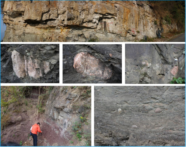
[Figure: The Nantuo Fm in the Yangtze Gorges (photos by Kuang Hongwei in 2010-2018)]
Synonym: (南沱组)
Lithology and Thickness
The Nantuo Fm is a glacial deposit. In the Wangfenggang section near Liantuo Town, the Nantuo Formation is dominated by massive glacial muddy gravel, generally is grayish green with minor red purple, and pebble-size is variable, poorly sorted, multiple shapes and complicated composition, bearing striations and nail-head pits. The upper part is intercalated with lenses of thin-bedded sandstone, and the top of well-stratified clayey sandstone and sandy clay bearing fragmentary granules. The thickness varies from tens of meters to more than hundred meters
Relationships and Distribution
Lower contact
In the type area, the basal part, composed of greenish gray massive pelitic and sandy conglomerate, rests disconformably on the underlying Liantuo Fm (greenish gray and purple red tuffaceous siltstone, silty mudstone interbedded with tuffaceous fine sandstone).
Upper contact
The top part composed of greenish yellow pebbly sandy claystone disconformably underlies the gray white siliceous dolomite of the Doushantuo Fm
Regional extent
The Nantuo Formation is distributed in the Yangtze and Jiangnan stratigraphic subregions
GeoJSON
Fossils
It yields microplants Leiopsophosphaera densa, L. leguminniformis, Trachysphaeridium sp., Trematosphaeridium holtedahlii, T. minutum, Taeniatum crassum, Laminarites antiquissimus etc.
Age
Depositional setting
The Nantuo Fm is the glacial accumulation of the Nantuo glaciation. The deposits of late Nantuo stage, when the glacier began to melt, shows locally the character of the glaciofluvial deposit, bearing varved beds and dropstones.
Additional Information
The paleolatitude is 19° (Zhang Huiming et al., 1982).